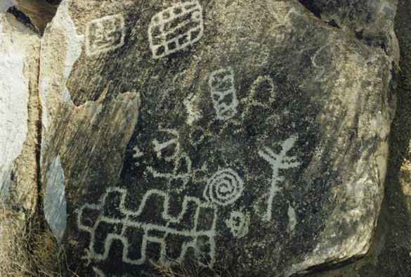
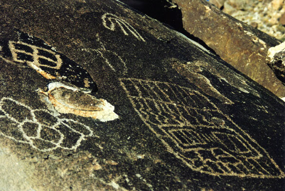
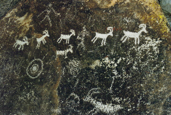
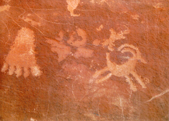
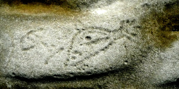
Whale Valley

RBarnesWadiHitan.jpg
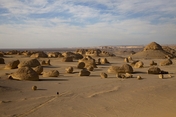
Photograph by Richard Barnes

My copy of the August issue of the National Geographic magazine arrived yesterday. I always enjoy most of the articles they publish but as you know, my favourites are anything to do with rocks and archaeology and the related sciences. This time I was thrilled to see a fascinating article and many gorgeous photos of Wadi Hitan, the Valley of the Whales in Egypt and the whale bones found there. There are some surprising discoveries concerning the evolution of the whales. All this is available online so enjoy!

Some of you might remember my post of five years ago when I first learned about this remarkable place. You might also enjoy this story and photos by Jenny Bowker, a quilt artist who visited Wadi Hitan while living in Egypt.

South Nevada rock art, part 4

Below are several more of guest contributor Loretta’s amazing photos of petroglyphs from the Grapevine Canyon near Christmas Tree Pass – please visit part 3 for the information.

XmasGrapevineCanyonWall1.jpg

XmasGrapevineCanyonWall2.jpg

XmasGrapevineCanyonWall3.jpg

XmasGrapevinePetroglyphs1.jpg

XmasGrapevinePetroglyphs2.jpg< Please see also part 1 and part 2 of the series if you missed them.

I want to thank Loretta for so generously sharing her fantastic photos here. I look forward to possible continuing collaborations in the future when she may have more to show us!
All photographs © Loretta

South Nevada rock art, part 3

We continue this short collaborative series with guest contributor Loretta who is kindly sharing her observations and photographs of some of the rock art found in her home region in the southwest US. (Please see part 1 and part 2.)

XmasGrapevine3sheep.jpg

XmasGrapevine6sheep.jpg

Grapevine Canyon near Christmas Tree Pass has one of the largest numbers of petroglyphs in one place in S. Nevada, and one of the most accessible. The pass is well marked, just a few miles off the main highway west of Laughlin, which is on the Colorado River. From a parking lot, you trudge along a sandy dry river bed until huge dark boulders rise before you, framing the canyon. An astonishing number of petroglyphs completely cover the boulders. As you turn to look back down the river bed, a broad vista opens up, taking your eye down toward the Colorado River and beyond to the rugged mountains of Arizona.

The dry river bed has its origins near the top of the canyon, where reeds and wild grapevines announce the presence of water. Bits of green edge the trickle of water coming down until it disappears under the boulders, hiding its life-giving essence from the harsh desert sunlight.

The petroglyphs themselves are remarkably well-preserved, with only a few having been defaced. One can imagine the good times enjoyed by the ancient travelers in this gathering place as they shared stories and carved pictures as illustrations to leave for others to find – could they have imagined us, now, wondering and puzzling over them?

A fascinating related link: How to make a petroglyph (thanks to gabriolan)

All photographs © Loretta
See also: part 4

South Nevada rock art, part 2

We continue the series by guest contributor Loretta who shares her observations and photos of rock art from her home region in southwest US, with links added by me. Please first visit Part 1 should you have missed it.

ValleyOfFireRockFormation.jpg

The Valley of Fire State Park lies within the sky glow of Las Vegas, about 55 miles east of the city lights. The Park is reknowned for its scenic red rocks, petroglyphs, and petrified wood, and is easily accessible by car. You can drive from one spot to another and take short hikes to view the scenery. Wandering the well-marked trails in the park, one finds it hard to think that civilization (well, Las Vegas, anyway) is so close by.

The park is Nevada’s largest, dedicated in 1935, and is popular with tourists and locals who bring their visitors for a sample of the non-gaming side of Nevada. It is not a place to experience the solitude that the desert offers in many other locations, but the petroglyphs and scenery make it well worth the trip. The weathered red sandstone rock formations rise against the backdrop of the dry Mojave Desert. The land slopes gradually down toward the once mighty Colorado River, now held back by Hoover Dam to form Lake Mead. The lake itself is about 100 feet below normal levels, due to a years-long drought in the West and the ever-increasing demands of humans.

We visited the park in December during the school holidays several years ago when our son was visiting. The weather was perfect, sunny with a slight chill in the air in the shady spots. The presence of other people made it difficult to reflect much on what we were seeing, the petroglyphs, but I take pleasure in going back to look at the photographs at my leisure.

Some of the petroglyphs are scraped onto the dark “desert varnish” on the rock, others onto the red sandstone. The work has been attributed to the “Basket maker people” and the later “Anasazi farmers” inhabiting the area from about 300 B.C. to 1150 A.D. according to Park information. I especially like the rock formation picture, above. Though not a petroglyph, its huge round shape and rough form seem to have a human meaning. Or not…all in the eye of the beholder!

ValleyOfFirePetroglyphs2.jpg

Desert bighorn sheep (NV state animal) often provided subject matter for the rock artists along with the atlatl, as depicted on “Atlatl Rock.” The atlatl is an ancient hunting tool that allowed a projectile to be thrown with force and accuracy.

ValleyOfFirePetroglyphs4.jpg

The linked figures are intriguing. Is it a family motif? Or more ritualistic, with the stylized large figures on the left – shamans, perhaps – leading the more recognizable human figures – a man and woman – in a ceremony or dance?

ValleyOfFirePetroglyphs3.jpg

Another set of figures, high on a canyon wall, seem to depict a person wearing a horned headdress joining hands with two unadorned people.

ValleyOfFirePetroglyphs1.jpg

The footprint petroglyph shows signs of vandalism, unfortunately, where someone scratched across the rock face. For centuries, the petroglyphs withstood the elements, wind, rain, desert heat. I hope they will survive the modern era.

All photographs © Loretta
See also:
part 3
part 4

South Nevada rock art, part 1

I’m thrilled to introduce Loretta as a guest contributor who will be most generously sharing her observations and amazing photos of rock art that she has found in her home region in southwest US. Loretta has done all the hard work for this short series we are doing so please welcome her with your comments. Now in Loretta’s own words….

Greetings from the Mojave Desert in southern Nevada. When I discovered Marja-Leena’s blog, I felt a kinship due to her interest in ancient rock art and a shared Finnish heritage. All of my grandparents immigrated from Finland prior to World War I, arriving in Upper Michigan. I had the good fortune to visit Finland, in 2001 and 2007, with my sister. We discovered long-lost cousins who greeted us with warmth and gracious hospitality. While there, I became aware of the images that the Sami people in the far North of Finland – still known as Lapland to most of the world – use to decorate their drumheads and other objects. The images reminded me of the Native American pictographs and petroglyphs found in the West.

Reading Marja-Leena’s blog and seeing her petroglyph photos sent me searching through my photos (pre-digital!). I wrote to Marja-Leena and offered to send her some of my photographs of petroglyphs and pictographs found in southern Nevada to compare. She graciously offered to allow me to share them via her blog.

dry-waterfall.jpg

Petroglyphs and rock paintings (pictographs) appear in many locations around southern Nevada, most often near water. Although the origins and meanings of the markings are under discussion, clearly they have been created by ancient people recording events in their daily lives.

The two photos here I find most fascinating. My husband and I found this location after reading about it in a local newspaper. It is in a low range of mountains a mile or so off a main highway running across a wide valley containing a dry lake bed. Although seldom seen in the desert, water leaves evidence of its existence all around – dry lakes, streams, and rivers abound. Running water carved the rock formation pictured over eons, yet there is not a visible water source above it. It is at the end of a short slot canyon that opens out onto an alluvial fan sloping down across a busy highway to the dry lake bed.

WaterfallPictographsA.jpg

As we turned our backs on the highway and entered the canyon, the sound of silence enveloped us. I walked under a low hanging rock ledge along the canyon and happened to look up to see two faint paintings on the ceiling above me – a figure with encircling arms and a sun, perhaps? They are not visible to anyone unless you walk under the ledge and look up. They reminded me of the first rock painting that I remember seeing – a red hand print on the wall of a cliff, high above a trail in Montana at the confluence of the North and South Forks of the Sun River. My good fortune is to have seen these reminders of those who have gone before me.

All photographs © Loretta
Further reading: Nevada Rock Art Foundation
and the rest of the series:
South Nevada rock art, part 2
South Nevada rock art, part 3
South Nevada rock art, part 4

a special Easter greeting

Easter_2010_Loit_small.jpg

We received this astonishing Easter greeting this morning from artist friends Loit and Virge Joekalda in Tallinn, Estonia. I’m so in love with it that I asked permission to share it here.

Loit wrote that last fall he made a trip to visit rock art sites in England with Paul Bahn under the guidance of “top rock art researcher and archaeologist Stan Beckensall”. Loit made this frottage (rubbing) of one site in Northumberland. The ‘world’ egg is an amazing touch, isn’t it!?

I’ve mentioned the Joekaldas a number of times. Most recently, three years ago I wrote this:

Tallinn has a special place in my heart. Newer readers may not know that in 2002 I had an exhibition in Finland with two other Canadian artists and friends. We travelled to and around Finland and also Tallinn on the other side of the Gulf of Finland. We fell in love with Tallinn where we met and became friends with artists Loit and Virge Joekalda (whom I’ve mentioned a few times elsewhere on this blog). The Estonians are close cousins to Finns, as part of the Finno-Ugrian group of peoples, so it was thrilling for me to see Loit’s exhibition of frottages and photos from his expeditions to sites of rock art by Finno-Ugrians in Karelia.

More related links:
Our visit to Tallinn and meeting the Joekaldas
Loit’s rock art calendar

I used one of his photos from that calendar in a work of mine: Vyg & Willendorf.
How this came together as a part of my exhibition in 2005

And read about Virge Joekalda

Thank you both, Loit and Virge, for your friendship and amazing influences on my own work!

revisiting Hornby’s petroglyphs

HornbyPetroglyph1A_2009.jpg

HornbyPetroglyph2B_2009.jpg

This year’s mini-vacation to Hornby Island was a sort of pilgrimage for me as we revisited some favourite spots from past visits. It must be over 15 years ago when we first saw the petroglyphs made by early First Nations peoples. Interestingly, those first photos were captured on film. They later appeared in several of my prints and in a book.

Sadly, the petroglyphs have worn down considerably since then for they are next to the sea and we could find only these two this time. The bright morning light meant the carvings appeared very faint in my digital photos so I’ve had to manipulate these images to bring out the contrast, hence the excessive graininess where the rocks were actually quite smooth. I’m so happy to have seen them again.

Related links:
my petroglyph photos in a book
a petroglyph photographed long ago

ADDENDUM November 10th: To answer Joe’s excellent question in the comments below, I’ve gone to the book mentioned in the link above: In Search of Ancient British Columbia, and the chapter on the Gulf Islands. On page 225, titled Petroglyphs, where my photographs are also featured, authors Philip Torrens and Heidi Henderson write:

Because petroglyphs are carved from rock rather than from bone or other organic matter, archaeologists cannot determine their ages using carbon-14 or other radioactive dating techniques. Attempts to determine ages by erosion are challenged by the fact that we have no way of knowing how deeply carved the grooves were in the first place. Given the heavy rain on most of the B.C. coast, it seems improbable that any surviving petroglyphs date back to the beginning of human presence here – at least 12,000 years ago. Estimates of their ages range from a few thousand years to less than a century, depending on the petroglyph and its location.

Ancient Britain: Avebury

AveburyStones.jpg

AveburyStones5.jpg

AveburyStones2.jpg

AveburyStones3.jpg

AveburyStones4.jpg

AveburyChurch.jpg

Last of our destinations during our day long tour of Ancient Britain was Avebury. Like Stonehenge, Avebury is very well-known and many believe it is the superior stone circle. Certainly it is the largest of its kind by area and number of standing stones. I’ve read conflicting information on the original number of stones of which many have been lost or damaged, one site says 98.

My personal impression of the Avebury stone circle was of some disappointment. I was not able to feel the magic I felt at Stonehenge. Certainly it was accessible, being able to walk into the enclosed pastures and right up and among the stones. Their sizes varied quite a bit, from small to a bit over human height, and the shapes from tall and slim to chunky and square, and all placed at some distance from each other. I knew it would be quite different from Stonehenge’s smaller circle of bigger standing and horizontal stones.

But… there is a road and a town breaking up the circle so we could not see the whole. We were able to walk around one area, much too slowly because we were taking photographs while also stepping carefully around dozing sheep and their droppings. Pastoral and pretty, yes. I wondered if we had gone the best way around for we noticed most of the others walking elsewhere including on the surrounding henge. Perhaps our guide could have been a bit more helpful in suggesting the best walking route. We had arrived late in the day behind schedule, so there was not enough time left to see it all. We finally had to rush for a much-needed bathroom break and a take-out cup of coffee before returning to our van to head back to London. Anyway, essentially it was far too short a time to capture the spirit of the place. That can be and usually is the way with guided tours, I know with some small experience.

As for photography, it seems that the best atmospheric photos are taken early or late in the day or during mist and rain. Almost four years ago I wrote about Avebury linking to a beautiful and informative site that I’m happy to see is still up: Avebury – A Present from the Past. It includes gorgeous photos, stories and information including other related sites in the area, but I can’t judge for the scientific accuracy. Also, this aerial view helped give me a better sense of the Avebury, Silbury Hill and West Kennet Barrow area – wish I’d had it with me on the tour.

As has been said in some of the earlier articles by me and some commentors, a first time tour really is to give general impressions, an overall picture and is helpful in showing what one wants to revisit alone in greater depth. It’s unlikely that we would have been able to cover so many places in one day on our own, which is one reason of course why we took this tour. I would love to spend more time in these ancient places of mystery and power so hopefully there will be another chance for me to revisit these sites, as well as many more, in the future.

I’m so very grateful to my husband for taking so many great photographs on this tour, especially under the time pressures, something that inhibits me from doing it. I just wanted to absorb the feel of these places though sometimes I would point out spots that I particularly wanted photographed. He told me that he was surprised how much he enjoyed this tour which makes me glad since I desired it, researched it and booked it.

Ancient Britain Tour series of articles:
Salisbury
Old Sarum
Wiltshire Flint
Stonehenge
White Horses
Silbury & West Kennet

Ancient Britain: Silbury & West Kennet

SilburyHill.jpg

WKennetLongBarrow.jpg

WKennetInside.jpg

Soon after passing the White Horse we could see Silbury Hill, a huge man-made chalk mound near Avebury. It is the tallest prehistoric man-made mound in Europe and one of the world’s largest.

Composed mainly of chalk and clay excavated from the surrounding area, the mound stands 40 metres (130 ft) high[2] and covers about 5 acres (0.020 km2). It is a display of immense technical skill and prolonged control over labour and resources. Archaeologists calculate that Silbury Hill was built about 4750 years ago and that it took 18 million man-hours, or 500 men working 15 years…. Mackie asserts that no simple late Neolithic tribal structure as usually imagined could have sustained this and similar projects, and envisages an authoritarian theocratic power elite with broad-ranging control across southern Britain.

It still seems a mystery as to why it was built. It is off bounds now but we could see it well from the road and as we walked up a hill or ridge nearby on top of which lies the West Kennet Long Barrow, a Neolithic tomb or barrow. Older than Stonehenge, this too was a marvel of construction and many man hours of labour. Open and accessible, I thought it would be spooky to go in but some clever openings cut into the sod above it gave a little light to see the construction of stones holding up walls and ceiling and reveal a central passage and several adjoining small bays. Spooky though to know this was a tomb.

Our stop was not long enough for serious photography. There are some nice photos at wikipedia, and probably at some of the numerous sites online, and one can also view the inside of West Kennet Long Barrow via this cool interactive VR Panorama.

Avebury is next, our last tour stop before returning to London.

Posts about our Ancient Britain Tour:
Salisbury
Old Sarum
Wiltshire Flint
Stonehenge
White Horses
Avebury

Ancient Britain: Stonehenge

stonehenge1.jpg

stonehenge2.jpg

stonehenge3.jpg

stonehenge4.jpg

stonehenge5.jpg
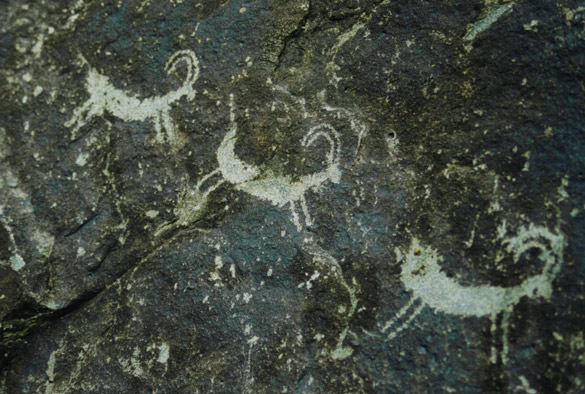
Wikipedia has a good gathering of all the information and further links to explore.

Instead I want to talk about the experience. Naturally I felt anticipation and excitement to be there after so many years of dreaming about seeing it. I wondered if it might be spoiled by a ‘tourist trap’ but it was okay, for we quickly passed by the tour buses and ignored the gift and ice cream shops, located some distance from the site. Our excellent tour guide quickly and clearly explained the history and construction in front of the educational display wall in the tunnel way under the road. Then we were on our own, walking up towards the stones. They seemed so small in the distance….

At first we felt the pressure of the busloads of visitors impeding the view, jostling each other to snap photos, giggling girls asking to have photos taken of them in front of the stones (do they even really LOOK at the stones?). Then it thinned out and we were able to spend quite a bit of time looking, contemplating and walking around it. For many minutes I stood alone, silent and breathing deeply and looking deeply. It would have been marvellous to be able to walk up and between the stones and touch them, but we could see some of the graffiti and damage and could understand why not. I just felt so grateful to be there.

My husband took numerous and excellent photos. I trusted him to it for he’s the better photographer when it comes to understanding the finer points of the camera and the light conditions and has very steady hands! If I use any of his photos from this trip in my art work, as I probably will, I’ll have to give him credit by making the works ‘collaborations’! Early morning or evening light might have given us more interesting and dramatic photos but I can’t complain for the weather was good for us – sunny though very windy, the clouds scudding along and providing a stunning canopy over these stones set in the open fields and gentle green slopes with grazing sheep and yellow patches of canola in the distance.

There is a sense of great space physically as well as in the huge span of time and spirits here. I felt awed yet calm as I kept thinking about the immense labours involved in bringing the stones here and erecting them, especially the sarsens. And I kept wondering over the mystery and many theories of why the ancient peoples built these stone circles and other similar sites in many other places. How fortunate we are to still have sites like Stonehenge as a way of reaching back and connecting with mankind’s ancient past.

I’d go back in a heartbeat.

stonehenge6.jpg

Other posts about our Ancient Britain Tour:
Salisbury
Old Sarum
Wiltshire Flint
White Horses
Silbury & West Kennet
Avebury