island hopping ’13, day 2

Ah-Wah-Qwa-Dzas.jpg

QuadraPetroglyph852.jpg

QuadraPetroglyph746.jpg

QuadraPetroglyph855.jpg

QuadraPetroglyph862.jpg

QuadraPetroglyph874.jpg

QuadraPetroglyph872.jpg

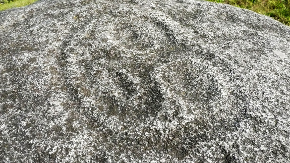
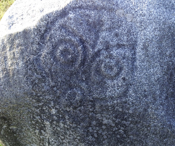
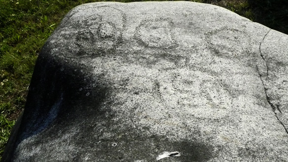
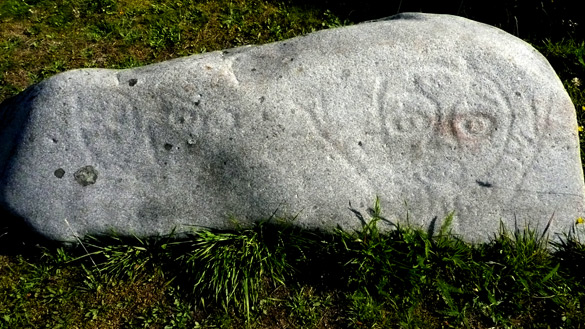
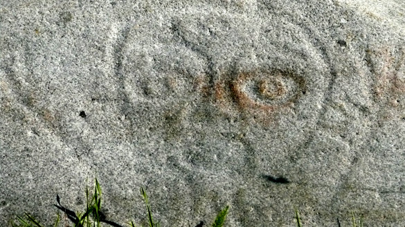
One reason we stayed at Campbell River the first night of our island hopping holiday was that we wanted to visit Quadra Island, a short ferry ride away. Some years ago when I was researching rock art around British Columbia, I had come across and written about Spirit in the Stone, a marvelous book by Joy Inglis, about the numerous First Nations petroglyphs on Quadra Island. It had been a longtime dream of mine to visit this island and its rock art, some about 3000 years old.

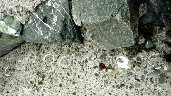
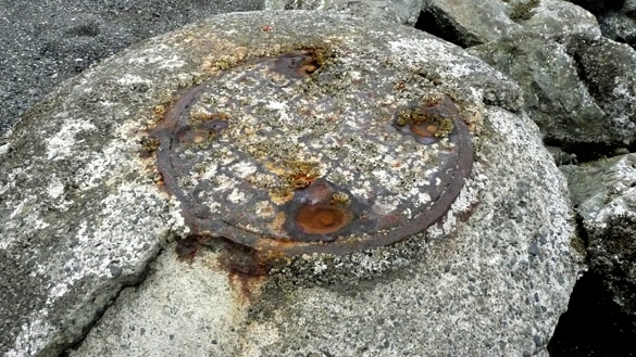
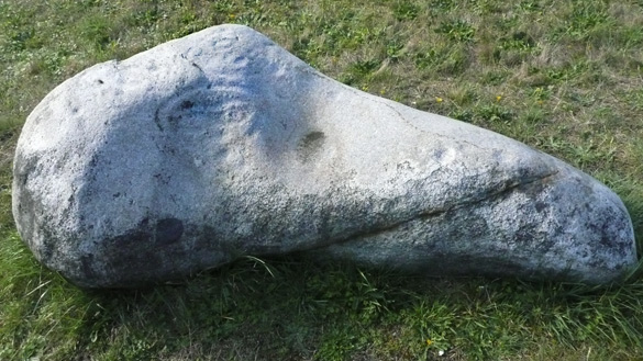
Our focus was to visit the museum and to see some of those stones that had been placed nearby. Photographing these were a challenge for the light was already too high and bright, so there was much processing needed, these ones being the best I could do. We did not have time to explore the whole island and visit other stones but hope to revisit again another time.

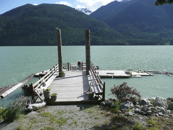
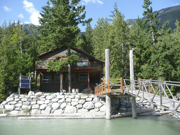
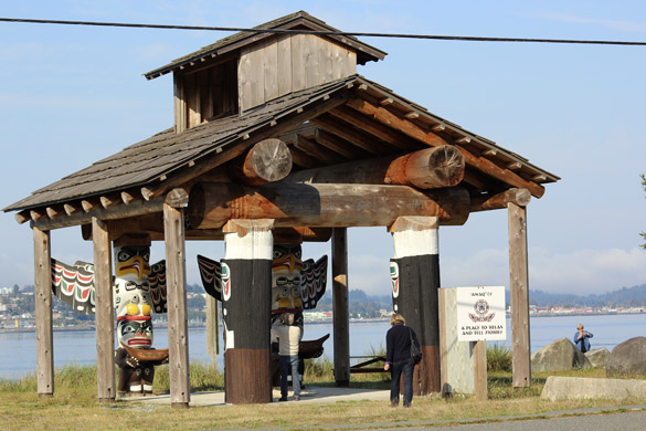
The top photo shows Ah-Wah-Qwa-Dzas, a gathering place on the shore in front of the museum. You can see Campbell River on the other side. We admired the displays inside the museum called the Nuyumbalees Cultural Centre – the numerous masks and other fine arts and crafts, a longboat, many photos of the old longhouses and much about the early history and impacts (many quite devastating such as several deadly smallpox epidemics) of white man’s arrival to these coastal communities. I think our German visitors found it all enlightening and sometimes quite shocking. No photos were allowed. Please do read the museum’s interesting website for more information.

island hopping ’13, day 1

sea_off_ferry.jpg

As I mentioned in my previous post, husband’s cousin Walter and his wife Elisabeth from Munich were with us for a visit for about ten days. They had first driven from Calgary over the Rockies to Vancouver, a very popular trip for European visitors. In Vancouver, we showed them around for a few days, then we headed out for an island hopping tour focusing mostly on the northern part of Vancouver Island and some smaller islands east of them, areas that we ourselves had not explored before.

Day One had us on the morning ferry from Horsehoe Bay to Nanaimo. We had dense fog all morning until about Buckley Bay where we stopped for refueling. This was a familiar spot where we have many times taken the two little ferries to Hornby Island. It was the only day, really a half day, on this journey that the sun did not shine which was quite incredible. We had only once, over 40 years ago, driven north of this point, in a rush to catch the overnight ferry to the northern port of Prince Rupert on our way home to Fort St. John where we lived at the time.

Our destination for the night was the town of Campbell River. We had heard how much it is thriving, attracting young families to jobs and affordable homes, and it certainly is an attractive, clean and pretty town. Our bed & breakfast place is in a nice quiet neighbourhood with lovely gardens. Inside we were astounded by the amazing art collection in the home, mostly prints, some paintings, sculpture and pottery, mostly by German artists. Elisabeth is very knowledgeable about art and was most surprised to learn that the owners, also German, had an art gallery in Munich before they came to Canada. Too bad they had to be away, leaving a friend to take care of us. (Sorry no photos since they weren’t there to be asked permission.)

CampbellRiver_boats.jpg

We had a lovely dinner by the pier where we noted numerous fishing ships, mostly owned by the First Nations. Breakfast next morning was a visual and gastronomic feast! Husband and I have said we’ll be back!

CampbellRiverBnB.jpg

Day Two was a highlight… report coming soon.

slow road, pt 5

dockLillooetLake.jpg

CottageB&B_LillooetLake.jpg

After a day (only a day since we left daughter’s place) of driving by astonishingly beautiful sights, we needed to stop for a night’s rest. We had booked in advance to stay at the Cottage B&B on Lillooet Lake. It’s off the grid on a beautiful lake with few occupants. The rough and narrow-at-times gravel road was a bit scary but we felt it was an adventure, reminding us of similar roads to cottages in our childhood. We felt instantly comfortable with the gracious hosts and enjoyed our spacious private space looking out on the water.

LillooetLake_south.jpg

driftwood_water.jpg

driftwoodfigure.jpg

We spent most of the evening relaxing on the dock, enjoying the sunshine and scenery. Numerous collected pieces of driftwood arranged here and there made me very camera happy (more in a future post). The sunset was a glorious finale for a fantastic day.

The other posts in the slow road series are here:
part 1, part 2, part 3, part 4, interlude, part 6 and the finale.

slow road, pt 4

overLillooet.jpg

We continue driving southwards along the winding Highway 99 which edges steep mountains overlooking the rushing Fraser River. Here we have come to a view over the town of Lillooet, one of the hottest spots in BC. Interesting history, if you feel like reading the link. We stopped for lunch here.

SetonLake.jpg

Soon after we come upon beautiful Seton Lake, with a portion of this informative sign below.

SignSetonLake.jpg

whitewater.jpg

We pass many whitewater streams, exciting glimpses of glacier topped peaks and another lovely lake,

glacierPeaks.jpg

DuffeyLake.jpg
Duffey Lake

Photos just cannot do justice to the huge majesty of the snow topped mountains, rivers, lakes and trees. Next stop, our bed-and-breakfast stay.

ADDED later: a cropped scan of a map I found in our favourite Beautiful BC Travel Guide (1994 ed.). Please follow the lime green line I traced along our route from east of Kamloops west, then south to Vancouver. I hope it gives a better idea of our slow road home.

SE-BC-MAP.jpg

Added even later: The rest of the slow road series may be viewed at the links below,
part 1, part 2, part 3, part 5, interlude, part 6 and the finale.

slow road, pt 3

quarry.jpg

quarry2.jpg

quarry3.jpg

We left the dry grasslands of the south Cariboo region by taking the highway heading southwest through mountains and green forests, eventually to Whistler by the back route. It felt more like home already. It had been more than a decade since we’d travelled this way but we remembered its grand beauty and wished to see it again.

Soon in was a stunning sight of a mountain side that was being quarried. Catching too-brief glimpses through the trees, we were amazed by the textures of the rock. We were reminded of the views of quarried mountains in northern Italy, minus the forest. But here there were no posted signs and no human activity and I could not find any information online. It may be a First Nations operation. We also saw stunning areas of reddish colour here and there, reminding me of native pictographs (of which there are some in the area, I’d read).

ChimneyRock.jpg

Then, wow, we caught glimpses, like a mirage, of an unusual pointed rock formation. We had to go back and forth along the road to find a bit of an open spot in the trees to capture this photo. I think it may be called Chimney Rock within Marble Canyon Provincial Park, an area of lovely small lakes which we could not see from the road.

The other parts of this series are here:
part 1, part 2, part 4, part 5, interlude, part 6 and the finale.

slow road, pt 2

KamloopsLake.jpg

KamloopsLakeSign.jpg

KamloopsLake2.jpg

KamloopsLakeValley.jpg

Continuing west (see part 1) from the city of Kamloops along the Trans-Canada Highway, we soon came upon a magestic view over Kamloops Lake as the highway skirted around it. Funny how we had forgotten it from not traveling this route in a couple of decades at least. The dry grassland hills are still relatively green from a wet spring.

We appreciated how many roadside viewpoints are provided along this major cross-Canada route compared to the Coquihalla Highway, built much much later for truckers looking for a faster route to and from the coast. As you can see from the sign on the west end of the lake, this was an active water transportation route in the old Gold Rush days in BC. We’ll be entering some of that Gold Rush territory further on in our slow journey home.

The rest of the series are here:
part 3, part 4, part 5, interlude, part 6 and the finale.

slow road, pt 1

NThompsonSlopes.jpg

NThompsonSlopes2.jpg

NThompsonSlopes3.jpg

NThompsonSlopes4.jpg

NThompsonSlopes5.jpg

Recently we took a few days’ trip to visit our eldest daughter and her partner who live in the North Thompson River valley, east of Kamloops, BC. With us was also our eldest granddaughter who was eager to see her aunt and was going to stay there for a few days longer than us. As always it’s a gorgeous drive by way of Coquihalla Highway, through high mountains and steep valleys.

We enjoyed excellent gourmet meals prepared by Richard. We gave them a hand with work in their huge garden. One evening we went out for a superb Greek dinner in Kamloops followed by a tour of the city including the Thompson Rivers University campus with its magestic view of the city and the river valleys. (Sorry, we took no photos!)

We had planned our return journey via the longer and slower route which we had not travelled in many years. Leaving the family, we first took the slow ranch country road along the north side of the North Thompson River (the main highway runs along the south side) only as far as Kamloops. I was eager to get a closer look at the unusual rock formations along the north slopes of the mountain range straddling the river. I like to call these “pre-Hoodoos” because they are in early stages. At home via the internet, I learned that further west yet nor far from Kamloops, there are true hoodoos – for next time!

I’ve blogged several times about past trips to this area, but suggest just this one from a trip in summer 2010 which shows two more photos of the North Thompson River valley. More to come about the rest of the slow road home.

Added 25th June: Tom’s comment below made me think that some of my newer readers (like Tom) likely haven’t delved deep into the almost 10 years of archives on this blog. I’ve written a fair bit about rock formations, petroglyphs and such related phenomena and how these have inspired my art work. Hoodoos are one such so I have gathered together some links below to past posts about them, should they be of interest to some readers. I enjoyed the revisit myself!

~ on badlands, hoodoos & petroglyphs
~ what are hoodoos?
~ visiting Writing-on-Stone Provincial Park
~ more about Writing-on-Stone

UPDATE later: The rest of the series may be found at the links below:
part 2, part 3, part 4, part 5, interlude, part 6 and the finale.

my red diary

red-diary.jpg

I’m not a diarist except when traveling and this has been my favourite travel diary. I love the texture, colour and pattern of the cover, and that it was a gift from a dear friend. Though it is last year’s, it still resides on my desk. I note that only the pages in May and June have entries about a trip to the westcoast of Vancouver Island and a trip to Montreal. Both were highlights of that year though we did do some other little trips here in BC. This blog is my diary.

beach walk, Victoria (2)

More of my favourite images from our walk on Cordova Bay, on our visit back in May.

CordovaBay342.jpg

CordovaBay340.jpg

CordovaBay349.jpg

CordovaBay320.jpg

CordovaBay327.jpg

CordovaBay352.jpg

Can you spot which of these show the hand of man upon nature?

beach walk, Victoria

CordovaBay330.jpg

CordovaBay331.jpg

CordovaBay332.jpg

I’m so glad to have my blog back after the server problems – strange how it broke my rhythm in writing. As I’m thinking of what to post, I remembered that I’d not finished describing the latter half of our island getaway in May, after we left Gabriola Island and headed south on Vancouver Island. So to recapture the rhythm, I’ve gone back into my photos and jumped into a series I took on Cordova Bay, in Victoria. We stayed with dear friends in the area who took us for a long walk along this beach in low tide. What beauties to be seen there, even these bluffs dripping with algae and seaweed.